
TRW Insight / Bangladesh
Boundary disputes are decided by maps and measurement before they are decided by judges, and rights of way, light and water by the Easements Act 1882. Choosing the right record, survey and forum early decides the outcome.
Boundary dispute Bangladesh law in 2026: demarcation, survey and easements
A boundary dispute Bangladesh landowners face is rarely about who owns the land. It is about where one owner's land stops and the next begins: a wall built two feet over the line, a drain cut across a neighbour's plot, a path used for decades and suddenly blocked, or a window that loses its light when the house next door rises three storeys. These disputes are small in area and large in consequence, and the wrong first step turns a measurement problem into a criminal complaint.
This guide covers demarcation by the Assistant Commissioner (Land) and survey officers under the Survey Act 1875 and the State Acquisition and Tenancy Act 1950, the mouza map, khatian and digital survey, commissions for local investigation under Order XXVI of the Code of Civil Procedure, declaration and injunction suits, section 145 proceedings and the Land Crime Prevention and Remedy Act 2023. It then sets out the law of easements under the Easements Act 1882: rights of way, light, air and water, prescription, necessity, extinction and limitation.

Summary: A boundary dispute is resolved in three layers: the record (khatian, dag number and mouza map), the ground (a measured demarcation against that map) and, if the parties still disagree, a forum that can bind them, usually the civil court through a declaration, possession or injunction suit supported by a survey commission. Rights over a neighbour's land, such as a path, light, air or water, are governed by the Easements Act 1882, which recognises easements by grant, necessity, custom and twenty years' prescriptive use.
Key point: Measurement comes before litigation. Courts, magistrates and land offices all decide boundary disputes by laying the survey map on the ground, so the party who commissions an accurate demarcation early, with the neighbour invited, usually controls the case. Self-help is the costliest mistake: damaging boundary marks is an offence carrying up to two years' imprisonment, and the Easements Act forbids a dominant owner from removing an obstruction himself.
At a glance
Map first
The khatian, dag number and mouza map define the plot; a demarcation lays that map on the ground.
Survey Act 1875
Sections 40 to 46 let the Collector settle boundary disputes arising during survey and relay old boundaries.
Civil court
Declaration, possession and injunction suits, with a commission for local investigation, give a binding answer.
Twenty years
Peaceable, open use as of right for twenty years creates a prescriptive easement; sixty years against Government land.
No self-help
Damaging boundary marks is an offence, and a dominant owner cannot himself remove an obstruction to an easement.
Table of Contents
What a boundary dispute Bangladesh courts hear actually involves
Most land conflicts are title disputes: two people claim the same plot through competing deeds, inheritance or records. A boundary dispute is narrower. Both neighbours usually accept each other's title; the question is the line between them on the ground. The evidence that decides it is therefore technical rather than documentary: survey maps, plot measurements, old boundary marks and the history of physical possession.
The same strip can raise several questions at once. A neighbour who builds over the line raises a boundary, a possession and an injunction question. A neighbour who blocks a path or drain raises a question about rights over another person's land, which is easement law rather than ownership. Identifying which is really in issue is the first decision in any boundary dispute Bangladesh practitioners take on. The recurring patterns are encroachment by a new wall or building, disagreement over a partition line, a mismatch between khatian area and the ground, private land adjoining khas land in the same dag, and interference with access, drainage, light or air.
How this guide fits with other TRW insights
This article focuses on demarcation, survey evidence and easements. For strategy across forums, see how to resolve land disputes in Bangladesh and the land dispute litigation guide. Correcting a wrong record is covered in khatian correction in Bangladesh, and deliberate encroachment in our land grabbing case analysis.
The records that fix a boundary: khatian, dag and mouza map
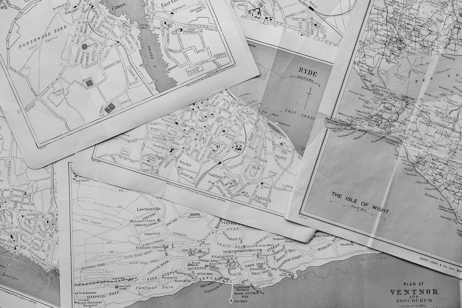
Every plot is identified by its mouza (revenue village), its dag or plot number on the mouza map, and the khatian (record of rights) listing the owners and the area of each dag. The khatian says how much land a person holds; the mouza map shows where it lies and what shape it has. A boundary dispute is, at its core, a disagreement about how a line on the map translates to the ground.
Bangladesh has several survey layers: CS, SA, RS and the Bangladesh Survey (BS) or city survey, explained in our khatian correction guide. The latest finally published record usually carries most weight, but older maps remain important evidence where a later survey shifted a line. Obtain certified copies of the khatian and mouza map sheet for every relevant survey, and check whether either plot was later subdivided.
Pleading the plot properly
A plaint concerning immovable property must describe it sufficiently to identify it and, where it can be identified by boundaries or by numbers in a record of settlement or survey, must specify them.[11] A vague schedule is a common reason why encroachment decrees cannot be executed. Give the mouza, JL number, khatian and dag numbers for each survey, the area claimed and the four boundaries, and attach a sketch map where the disputed strip is narrow.
When the record itself is wrong
If the latest revised record places land in the neighbour's dag, the first remedy may lie before the Land Survey Tribunal. A person aggrieved by the final publication of the last revised record of rights may sue within one year of publication or of the tribunal's establishment, whichever is later, with a further year if the tribunal accepts the reasons for delay; the tribunal can declare the record incorrect and direct correction.[2]
Demarcation under the Survey Act 1875 and through the AC Land
The Survey Act 1875 was enacted to secure landed property, prevent encroachments and disputes, and provide for surveys and boundary marks. Its dispute provisions are short but explain why, in a boundary dispute Bangladesh survey officers rather than judges often draw the first line.
Disputes arising during a survey
Where a boundary dispute comes to notice during a survey, the Collector may decide it after such inquiry as he thinks necessary, fixing the boundary on the basis of actual possession and securing it with boundary marks. His order has the effect of a civil court order declaring possession until reversed or modified by a competent authority.[1] If possession cannot be determined, he may take the land under his control until a party establishes its right, and with consent he may refer the dispute to arbitration.[1]
Relaying old boundaries
Where a court fixed a boundary, or a revenue survey or settlement mapped it without objection, the Collector must relay it where revenue or government interests are affected and may do so otherwise. Relaying does not change possession, and a new line may be adopted only if all parties agree, with reasons recorded.[1]
Demarcation through the upazila land office
Outside a formal survey, owners apply to the AC Land for demarcation by the upazila surveyor or kanungo against the mouza map. A Ministry of Land circular of 28 September 2026 illustrates the method: where private and government-interest land share a dag, the AC Land must separate them on the ground with all concerned parties present, prepare a jointly signed draft map after reviewing past and current records, the plot index and the mouza map, and hold a hearing if needed before mutation proceeds.[3]
Outside the Survey Act framework, a demarcation report is strong evidence but not a judgment on title, and it does not bind a neighbour who disputes it. Its value lies in what follows: a signed joint map often ends the dispute, and an unsigned one shows the court exactly where the parties differ. Insist on written notice to every adjoining owner, photographs of the marks placed, and a measured sketch keyed to the map sheet.
Digital survey, e-mutation and land tax: the 2025 to 2026 changes
In April 2026 the Land Minister told Parliament that pilot drone-based surveys were under way to improve map accuracy and reduce forgery and record errors, with nationwide expansion to follow gradually, that e-mutation was mandatory with SMS alerts at each stage, and that land development tax could be paid online.[4] For owners in survey areas, the lesson is unchanged: attend when surveyors measure, point out the boundary, and object at the draft stage. A line drawn wrongly on a digital map is as hard to move as one drawn by hand.
The Land Development Tax Act 2023 (Act No. 31 of 2023) governs the levy of land development tax, provides for electronic collection, and addresses assessment where a plot is divided by inheritance or held by several owners.[5] Tax receipts help prove a claim of possession over a defined area, but not the position of a line. The September 2026 circular adds that mutation of the private portion of a mixed dag gives no rights over the khas portion, which must be noted in the new khatian.[3] A settled boundary should always be followed by land mutation so the record matches the ground.
Civil suits that settle a boundary dispute Bangladesh courts will enforce
When demarcation fails, the civil court is the forum that can bind both neighbours. The choice of suit depends on who holds the strip and what the defendant is doing on it.
Declaration of title and of the line
A person entitled to a right in property may sue for a declaration under section 42 of the Specific Relief Act 1877, but no bare declaration will be made where the plaintiff could have sought further relief and did not.[9] A plaintiff whose strip is occupied must add a prayer for possession; one facing threatened encroachment should add an injunction. The suit seeks a declaration that the strip forms part of the plaintiff's dag, as identified on the survey map, with consequential relief. Possession routes and their time limits are covered in our guide to recovery of possession.
Injunctions against building over the line
Where a neighbour is building, the usual tool is a permanent injunction with a temporary injunction pending trial. A mandatory injunction can compel the defendant to undo the encroachment; the Specific Relief Act's illustrations include pulling down a building that obstructs an acquired right to light and removing eaves projecting over a neighbour's land.[9] See our guides to the permanent injunction suit and temporary injunction.
The amin commission under Order XXVI rule 9
The decisive evidence usually comes from a commission for local investigation. Order XXVI rule 9 of the Code allows the court to issue a commission for a local investigation, and rule 10 makes the commissioner's report and depositions evidence in the suit, with power to examine the commissioner in person.[11] In practice the court appoints an advocate commissioner, often assisted by a survey-knowing amin, to measure the plots against a specified map. Name the map sheet and survey to be used, ask for existing marks to be identified, and object promptly if the report is wrong. A report measured against the wrong survey is the commonest ground of appeal.
Breach of the peace: section 145, section 147 and the Land Crime Act 2023
Boundary disputes turn violent more often than other land disputes because they play out between neighbours. Two magistrate-led routes keep the peace while rights are decided elsewhere.
Section 145 and section 147
Section 145 of the Code of Criminal Procedure applies where a District Magistrate or a specially empowered Executive Magistrate is satisfied that a dispute likely to cause a breach of the peace exists concerning any land or water or its boundaries.[12] The Magistrate decides actual possession, not title; the procedure is covered in our land grabbing guide.
Section 147 is the overlooked companion: where the dispute concerns an alleged right of use of land or water, the Magistrate may prohibit interference with the right if it exists, or its exercise if it does not.[13] No protective order is made if a year-round right was not exercised within three months before the inquiry, and every order yields to a later civil court decision.[13] For a blocked path, section 147 can restore access while an easement suit is prepared.
Boundary offences under the Land Crime Act 2023
Damaging the boundary or boundary marks of land in lawful possession, or the land, structures, trees or crops on it, is an offence punishable with up to two years' imprisonment and a fine; dispossessing or obstructing a lawful possessor without a competent order is a separate offence under section 7.[14] These offences are tried by a Judicial or Metropolitan Magistrate and may fall to a mobile court.[14] Restoration of possession by an Executive Magistrate under section 8 is unavailable while a civil suit on possession is pending, unless the civil court refers the matter, so sequencing matters.[14] The criminal route suits plain bad faith; where the line is honestly disputed, a complaint risks dismissal and a counter-complaint.
Easement law in Bangladesh under the Easements Act 1882
Many matters presented as a boundary dispute Bangladesh owners bring are really about rights over a neighbour's land: a path, a drain, light through a window, a flow of water. These are easements under the Easements Act 1882, which extends to the whole of Bangladesh.[6] An easement gives no ownership of the neighbour's land, only a right to use it, or restrain its use, for the better enjoyment of one's own.
Dominant and servient heritage
The land benefited is the dominant heritage; the land burdened is the servient heritage.[6] Easements are continuous, such as light through a window, enjoyed without any act of man, or discontinuous, such as a right of way; and apparent, shown by a permanent sign visible on careful inspection, or non-apparent.[6] The classification matters for implied grants and extinction. Natural rights are distinct: land in its natural state is entitled to support from adjacent soil, and riparian owners to the flow of a natural stream without material alteration.[6]
Rights of way
The right of way is the commonest easement, especially for plots created by partition with no road frontage. Unless a different intention is proved, a right of way of one kind does not include one of another kind, so a footpath does not become a vehicular road because the dominant owner builds an apartment block.[6] The right must be exercised in the way least onerous to the servient owner, who may require it to be confined to a defined part of the land where that causes no harm.[6]
Light, air and water
An easement of light or air attaches to a specific opening. Where acquired by prescription, its extent is the light or air accustomed to enter that opening during the whole prescriptive period, and no prescriptive right exists to light or air passing to an open space of ground.[6] An owner whose house has enjoyed light for twenty years may restrain a neighbour from blocking it; an owner of an empty plot cannot. For water, no prescriptive right can be acquired to surface water not flowing in a stream or permanently collected in a pool or tank, or to underground water not passing in a defined channel.[6]
Easement or licence?
A licence is permission to do something on another's land that does not amount to an easement or interest, and is generally revocable unless coupled with a transfer of property in force or the licensee has executed permanent works and incurred expense on it.[6] Many path claims fail because the use began with permission and never became anything more.
How easements are acquired: grant, necessity, prescription and custom
An easement may arise by express grant, by implication on transfer or partition, by prescription or by local custom. Express grants should be made by registered deed with a plan; the others must be proved by evidence.
Easements of necessity and quasi-easements
Where land is transferred, bequeathed or partitioned and an easement over the other land is necessary for enjoying the part received, the recipient is entitled to it; apparent and continuous easements necessary to enjoy the land as it was enjoyed at transfer also pass unless a different intention appears.[6] The route of a way of necessity is set by the transferor or the relevant co-sharer and must be reasonably convenient for the dominant owner, who may set it out if they refuse or neglect to.[6] Plots allotted in a partition suit without road access usually carry such a way, but it is far better to define its width and position in the partition deed or decree.
Prescription: twenty years of open use as of right
Where light or air to a building has been peaceably enjoyed as an easement without interruption for twenty years, or a way, watercourse or other easement has been peaceably and openly enjoyed by a person claiming it as an easement and as of right, without interruption, for twenty years, the right becomes absolute.[6] [7] The period must end within two years before the suit in which the claim is contested, and against Government land it is sixty years.[7]
An interruption counts only where enjoyment actually ceases because of another's obstruction and the claimant acquiesces for one year after notice.[7] Permission is fatal: an illustration to the Limitation Act dismisses a right-of-way claim because the claimant once asked the servient owner's leave.[7]
Rights that cannot be acquired, and custom
No right can be acquired by prescription that would tend to the total destruction of its subject.[6] An easement may also arise by local custom, which suits village paths and ghats used by a community rather than one neighbour.[6]
| Route | Legal basis | Who decides | Binding on title? | Best used for |
|---|---|---|---|---|
| Survey-stage decision | Survey Act 1875, ss 40 to 46 | Collector | Possession only, until reversed | Disputes raised while a survey is running |
| Administrative demarcation | Land administration practice and 2026 circular | AC Land, surveyor or kanungo | No | Fixing the line on the ground before talks or suit |
| Land Survey Tribunal | SAT Act 1950, s 145A | Tribunal judge | Corrects the record | Wrong dag or area in the latest record |
| Civil suit | Specific Relief Act 1877; Easements Act 1882 | Civil court | Yes | Title to the strip, possession, injunctions, easements |
| Peace proceedings | CrPC ss 145 and 147 | Executive Magistrate | No, possession or use only | Imminent violence over land, water or a path |
| Criminal complaint | Land Crime Prevention and Remedy Act 2023 | Judicial Magistrate | No | Deliberate damage to boundary marks or dispossession |
Suits to protect an easement: compensation, injunction and no self-help
The dominant owner or occupier may sue for compensation for disturbance of an easement where it has actually caused substantial damage; any act likely to injure the plaintiff by affecting the evidence of the easement, or materially diminishing the value of the dominant heritage, qualifies.[6] For air to a house, damage is substantial if it interferes materially with physical comfort, even if not injurious to health.[6]
An injunction may restrain disturbance where the easement is actually disturbed and compensation is recoverable, or where a threatened act must necessarily disturb it.[6] In practice an easement suit seeks a declaration of the right, a permanent injunction against interference and, where a wall or gate has been built, a mandatory injunction to remove it, with a temporary injunction pending trial.
The dominant owner may do acts reasonably necessary to enjoy the easement, such as repairing a drain, with as little inconvenience as possible, but cannot himself abate a wrongful obstruction.[6] Breaking down a neighbour's wall to reopen a path is unlawful even if the path is a valid easement, and may be an offence under the Land Crime Act.[14]
Extinction of easements under sections 37 to 51
An easement is extinguished when the servient owner's power to impose it ends, by release, by revocation under a reserved power, on expiry of a limited period or condition, when the necessity ends for an easement of necessity, when it becomes useless, by permanent change in the dominant heritage, by destruction of either heritage, and by unity of ownership of both heritages.[6] The Act's illustration of a way of necessity ending when the dominant owner buys land giving other access shows how quickly such a right can disappear.[6]
A continuous easement is extinguished by twenty unbroken years of total non-enjoyment, and a discontinuous easement by non-enjoyment for a like period, unless the dominant owner registers a declaration within that period, which preserves it for twenty years from registration. Non-enjoyment does not extinguish an easement where cessation follows a contract with the servient owner, where a co-owner continues to use it, or where it is a necessary easement.[6]
Restrictive covenants and obligations annexed to land
Bangladesh has no separate statute on restrictive covenants; the main rule is section 40 of the Transfer of Property Act 1882. A right to restrain the use of another's land for the more beneficial enjoyment of one's own, or a contractual obligation annexed to ownership that is not an interest or easement, may be enforced against a transferee with notice or a gratuitous transferee, but not against a purchaser for value without notice.[10]
A covenant restricting height, use or building lines therefore binds a later buyer only with notice, so it should be recited in every subsequent deed. A right meant to bind all future owners, such as a passage or drain, should be granted as an easement by registered deed with a plan. Common passages are a frequent flashpoint in developer and landowner disputes.
Limitation in boundary and easement cases
A suit for possession of immovable property must generally be brought within twelve years from dispossession, or from when the defendant's possession became adverse, and at the end of that period the owner's right is extinguished.[8] [7] A neighbour who has openly and adversely held a strip for more than twelve years may have acquired it. Suits with no specific article, including most stand-alone declaratory suits, carry six years from accrual.[8]
For a continuing wrong, a fresh period begins at every moment the wrong continues, so an ongoing obstruction can usually be challenged by injunction while it lasts.[7] A claim for compensation for obstructing a way or watercourse has its own article running from the date of the obstruction and should be filed promptly.[8] Limitation also builds rights: a dominant owner whose long use has been blocked must sue within two years for the twenty-year period to count, while a servient owner can prevent a right arising by giving written permission or openly interrupting the use.[7]
Running a boundary dispute Bangladesh owners can win
Cases are rarely lost on law, and a boundary dispute Bangladesh courts decide is no exception. They are lost because the plaintiff relied on the wrong map, pleaded the wrong strip, or acted on the ground before going to court. The sequence below reflects how we run these matters.
Collect the records
Obtain certified copies of every khatian and mouza map sheet for both plots, the deeds with their schedules, mutation records and tax receipts.
Identify the real issue
Decide whether the dispute is about the line, possession of a strip, a wrong survey record, or a right over the neighbour's land.
Check the deadlines
Calendar the Land Survey Tribunal window, the twelve-year possession period and the two-year window for prescriptive claims.
Demarcate with notice
Commission a demarcation by the upazila surveyor or a licensed surveyor, with written notice to every adjoining owner.
Try to settle on the map
Use the measured map to negotiate an exchange, sale, moved wall or defined passage, recorded by registered deed.
Choose the forum
File a declaration, possession or injunction suit, a Survey Tribunal suit, or a section 145 or 147 application, as the facts require.
Ask for a commission
Apply under Order XXVI rule 9 for a local investigation naming the survey map to be used, and object promptly to any flawed report.
Record the outcome
Follow any decree or settlement with mutation and, where useful, permanent boundary marks.
Evidence that carries weight
The core evidence is certified copies of every khatian and mouza map sheet for both plots, the deeds with schedules and plans, mutation records and tax receipts, and an independent demarcation report with photographs. For easements, add evidence of the duration and character of use: old photographs, local witnesses, the age of a drain or gate, and correspondence showing the use was asserted as of right.
Settlement and how to record it
Many disputes end once a reliable measurement exists: the strip is exchanged or sold, a wall moved, or a passage defined. Any settlement transferring land or creating an easement should be made by registered deed with a sketch map and followed by mutation. Once a suit is filed, court-annexed mediation can produce a compromise decree; see mediation in Bangladesh. Where the neighbour is the Government, remember the sixty-year prescriptive period and the 2026 insistence on ground separation of mixed dags.[7] [3]
What to watch in 2026 and 2027
As drone and GIS-based maps replace older sheets, disputes will follow wherever new maps shift old lines, making the survey objection stages the critical moment for owners.[4] Online mutation and tax records will surface latent boundary conflicts during sales and financing, and the land administration's insistence on separating mixed dags points to more demarcation before mutation.[3]
The fundamentals of any boundary dispute Bangladesh law presents remain stable: fix the record, measure the ground with the neighbour present, choose a forum that can bind the other side, and never take the line into your own hands. TRW handles these matters through our real estate disputes practice and our land records and khatian correction practice.
Frequently asked questions
Who decides a boundary dispute Bangladesh owners bring?
During a survey the Collector may decide it under the Survey Act 1875, with effect as a civil court order on possession.[1] Otherwise the AC Land can demarcate administratively, but only the civil court gives a binding decision on title and the line.
How do I get my land demarcated?
Apply to the upazila land office for demarcation by the surveyor or kanungo, with certified copies of the khatian and mouza map, and ask for notice to all adjoining owners. A jointly signed draft map is the best outcome.
What is an amin commission in a boundary dispute Bangladesh case?
A commission for local investigation under Order XXVI rule 9 of the Code of Civil Procedure, usually executed by an advocate commissioner with a survey-knowing amin who measures the land against a specified map. The report is evidence in the suit.[11]
Can I break down a wall my neighbour built over my land or path?
How long does it take to acquire a right of way by use?
Twenty years of peaceable, open use as of right without interruption, ending within two years before the suit; sixty years against Government land.[7]
What is an easement of necessity?
A right over other land that arises on a transfer, bequest or partition because it is necessary to enjoy the land received, such as access to a landlocked plot. It ends when the necessity ends.[6]
Can my neighbour's new building block my light and air?
If your building has enjoyed light or air through a particular opening for twenty years as an easement, you can restrain substantial interference. No prescriptive right exists for light or air to open ground.[6]
Can a magistrate stop a fight over a path or drain?
Yes. Section 147 of the Code of Criminal Procedure lets a Magistrate prohibit interference with a right of use of land or water where a breach of the peace is likely, subject to any later civil court decision.[13]
How does an easement end?
By release, revocation, expiry, end of necessity, uselessness, destruction, unity of ownership or twenty years of non-enjoyment, among the grounds in sections 37 to 51 of the Easements Act 1882.[6]
What changed in land administration in 2025 and 2026?
Source register
Primary legal and regulatory sources
Materials checked on 20 October 2026. Confirm the current official text before relying on any provision.
- Survey Act 1875 (Act No V of 1875), sections 40 to 46: procedure in disputes as to boundary — Laws of Bangladesh
- State Acquisition and Tenancy Act 1950, section 145A (Land Survey Tribunal) — Laws of Bangladesh
- Ekushey Television, 30 September 2026 — Ministry of Land circular on demarcating khas land in the same dag before mutation (Bangla)
- BSS, 15 April 2026 — Land Minister on e-mutation, online land tax and drone-based digital surveys
- Land Development Tax Act 2023 (Act No 31 of 2023) — ECOLEX
- Easements Act 1882 (Act No V of 1882) — Laws of Bangladesh
- Limitation Act 1908, sections 23 and 26 to 28 — Laws of Bangladesh
- Limitation Act 1908, First Schedule (articles 37, 120, 142 and 144) — Laws of Bangladesh
- Specific Relief Act 1877, sections 42, 54 and 55 — Laws of Bangladesh
- Transfer of Property Act 1882, section 40 — Laws of Bangladesh
- Code of Civil Procedure 1908, First Schedule (Order VII rule 3 and Order XXVI rules 9 and 10), updated April 2026 — Laws of Bangladesh
- Code of Criminal Procedure 1898, section 145(1) to (3) — Laws of Bangladesh
- Code of Criminal Procedure 1898, section 147 (disputes concerning rights of use) — Laws of Bangladesh
- Land Crime Prevention and Remedy Act 2023 (Act No 36 of 2023), sections 7, 8, 10, 19 and 22 — Laws of Bangladesh
Related TRW assistance
Move from information to a defined next step
TRW acts in boundary disputes, demarcation and survey objections, easement and right-of-way claims, and related injunction and possession suits across Bangladesh. Explore our real estate disputes practice, our land records and khatian correction practice, or contact TRW to have your plot reviewed.